Topographical
Surveys
Accurate site features, ground levels and constraints captured to OS grid coordinates — supporting planning applications, feasibility studies and design development.
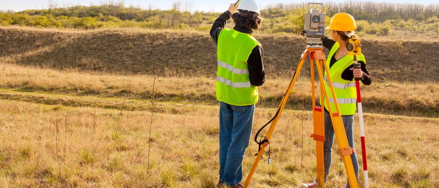
Add photo: topo-hero.jpg
Recommended 1400 x 600pxWhat is a Topographical Survey?
A topographical survey records the physical characteristics of a site, including all natural and man-made features and changes in ground level. This information provides an essential base for planning applications, feasibility studies and design development.
Without accurate topographical data, designers are working with incomplete or assumed information about a site — which can lead to costly revisions later. A topographical survey removes that uncertainty from the very start of a project.
What We Can Provide
Our topographical surveys are tailored to each site and project. Depending on your requirements, we can record and provide:
- Ground levels and spot heights across the site
- Contour lines at agreed intervals
- Buildings and structures with heights
- Boundaries, walls and fencing
- Roads, footpaths, kerbs and hardstanding
- Drainage features, manholes and service covers
- Trees and vegetation (including root protection areas where required)
- Street furniture, signage and utility covers
- Combined topo and measured building drawings where required
What We Survey
- Residential development plots of all sizes
- Commercial and mixed-use development sites
- Infrastructure, access and highway schemes
- Urban and rural sites
- Constrained or complex sites requiring careful methodology
Our Surveying Process
Fast, Accurate Data Collection
Site data is captured efficiently using modern surveying equipment. Where required, surveys are carried out to Ordnance Survey National Grid coordinates and OS datum levels — ensuring accurate spatial control and compatibility with planning submissions, existing site data and all consultant information from the outset.
Data Analysis & Quality Assurance
All captured data is carefully processed and validated. Coordinate control, level information and feature accuracy are reviewed as part of our QA process to ensure the survey provides a reliable and consistent foundation for design.
Fast, Reliable Delivery
Final topographical drawings are produced using professional CAD workflows and issued in agreed formats and timescales, structured for direct use in planning submissions and design software.
Why Choose SurveyX
OS Coordinate Control
Surveys completed to OS National Grid and OS datum ensure your data is compatible with planning authority requirements and integrates seamlessly with other consultant datasets.
Reliable Site Data
Accurate, dependable site information from the outset — supporting informed design and planning decisions and reducing the risk of costly surprises during construction.
Industry-Standard CAD Outputs
All drawings produced using professional CAD workflows, compatible with AutoCAD, BricsCAD and commonly used design and engineering software.
Clear, Well-Structured Plans
Topographical drawings are clearly annotated and logically structured — easy to interpret from day one, with no significant rework needed before design begins.
Experience Across Site Types
We have experience across a wide range of site types, sizes and constraints, adapting our methodology to suit each project.
What is a Topographical Survey?
A topographical survey — also called a land survey or topo survey — records the physical characteristics of a site in precise detail. This includes the shape and levels of the ground, all buildings and structures, boundaries, roads, drainage features, trees and any other significant site features.
The survey data is processed to produce detailed CAD drawings that give designers, engineers and planners a complete and accurate picture of the site as it exists — a critical foundation for any development, extension or infrastructure project.
Unlike measured building surveys which focus on what is inside and on the faces of a building, topographical surveys focus on the site itself — the ground, its levels, features and boundaries. The two services complement each other and are often commissioned together for projects involving both a building and its surrounding site.
What You Receive
A topographical survey is delivered as a set of professional CAD drawings showing all site features, levels and constraints. Below are examples of the types of outputs we produce.
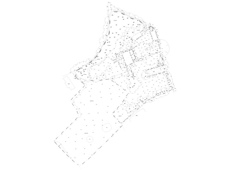
A topographical plan — showing all site features, boundaries and levels
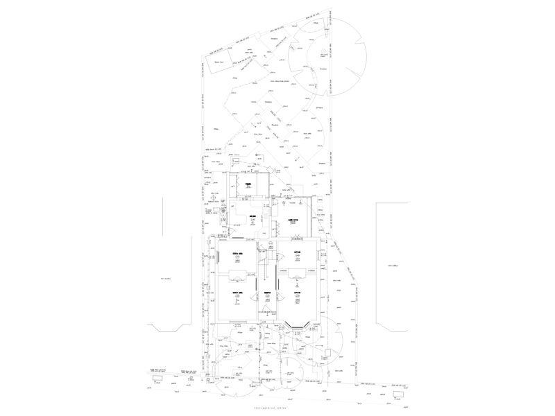
A combined topo and building survey — site and building in one drawing
Recent Projects
A selection of topographical survey projects completed for developers, engineers and planning consultants across the UK.
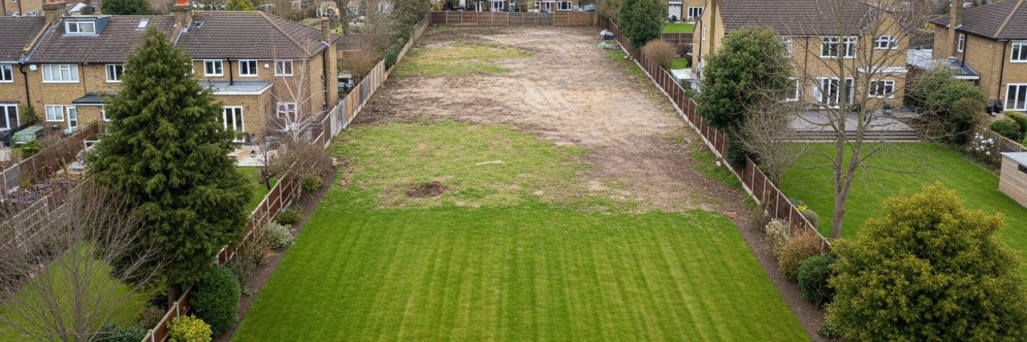
Residential Garden Plot Survey — London
A detailed topographical survey of a large rear garden to support a proposed residential development. Varied ground levels, restricted access through the main property, and a requirement for accurate boundary data for planning — all captured in a single site visit using professional survey equipment.
- Complete site data captured in a single visit
- Accurate topo plan delivered within project timeframe
- Feasibility and planning design able to proceed