3D Laser Scanning &
Point Cloud Surveys
High-accuracy point cloud data captured using the Leica BLK360 — for complex structures, refurbishment works and projects requiring precise spatial data with minimal site disruption.
Add photo: scan-hero.jpg
Recommended 1400 x 600pxWhat is a 3D Laser Scanning Survey?
A 3D laser scanning survey uses specialist equipment to capture millions of accurate spatial measurements in a very short time, creating a detailed digital representation known as a point cloud. This data provides a precise record of existing conditions, capturing complex geometry that is difficult or time-consuming to measure using traditional methods.
Point cloud surveys are particularly valuable on complex buildings, refurbishment projects and sites where access is limited — capturing everything in a single visit and reducing the risk of having to return to site for missed information.
What We Can Provide
Our laser scanning services are tailored to the scale and complexity of each project. Depending on your requirements, we can provide:
- High-density point cloud data covering the full building or site
- Registered and fully aligned scan datasets
- Colourised scans where applicable for easier navigation
- Data captured using the Leica BLK360 laser scanner
- Scans registered to OS grid coordinates where required
- Point cloud data ready for CAD, BIM and many different design workflows
- Scan-to-plan CAD drawings extracted from point cloud data
What We Survey
- Existing buildings of all ages and types
- Commercial and industrial spaces
- Complex or irregular architectural layouts
- Refurbishment, retrofit and extension projects
- Heritage and listed buildings
- Plant rooms, roofscapes and constrained areas
About the Leica BLK360
The Leica BLK360 is one of the most capable compact laser scanners available for building survey applications. It captures high-density point clouds with millimetre-level accuracy, alongside HDR photography for colourised scan outputs.
- Up to 360,000 points per second capture rate
- Full spherical scan coverage in each position
- Integrated HDR imagery for colourised point clouds
- Compact and non-intrusive — minimal site disruption
- Compatible with Autodesk ReCap for processing and delivery
Our Scanning Process
Fast, Accurate Data Collection
Laser scanning is used to efficiently capture complex geometry using the Leica BLK360. Dense, accurate point cloud data is collected with minimal site disruption. Where required, scans are tied to OS grid coordinates and levels to ensure compatibility with wider site and design information.
Data Processing & Quality Assurance
Point cloud data is processed and registered using Autodesk ReCap, aligning individual scan positions into a single, coherent dataset. The registered point cloud is checked for accuracy, alignment and completeness before delivery.
Fast, Reliable Delivery
Final point cloud data is issued in agreed formats and timescales, ready for direct use in CAD, BIM and professional design workflows. We can also extract 2D CAD drawings from the data as part of a combined scan-to-plan service.
Why Choose SurveyX
Leica BLK360 Technology
Data captured using the Leica BLK360 provides high-density, accurate point clouds suitable for demanding refurbishment, heritage and coordination projects.
High-Accuracy Survey Data
Reliable point cloud data that accurately represents existing conditions at millimetre-level precision — supporting confident design decisions without the need for re-measurement.
Industry-Standard Outputs
Deliverables in RCP/RCS and E57 format are compatible with AutoCAD, Revit, BricsCAD and most major design and engineering platforms.
Fewer Site Visits
High-density scan data captures everything in a single visit — reducing access requirements and eliminating the need to return to site for missed measurements.
Complex Geometry, No Problem
We have experience scanning buildings with challenging geometry, irregular features and difficult access — adapting our scan strategy to ensure full and accurate coverage.
What is 3D Laser Scanning?
3D laser scanning is a survey technique that uses a specialist instrument to capture millions of precise spatial measurements in a very short time. The scanner emits laser pulses in all directions, measuring the distance to every surface it can see. The result is a dense cloud of three-dimensional points — known as a point cloud — that together form an accurate digital representation of the scanned space.
Each point in the cloud has an exact X, Y and Z coordinate. The complete point cloud gives you a precise, measurable record of the building or space as it exists — one that can be navigated in 3D, measured at any point, and used as the basis for CAD drawings, BIM models and detailed analysis.
We use the Leica BLK360 — one of the most capable compact laser scanners available for building survey applications. Its combination of accuracy, speed and non-intrusive operation makes it ideal for all types of building, from occupied offices to heritage structures.
What You Receive
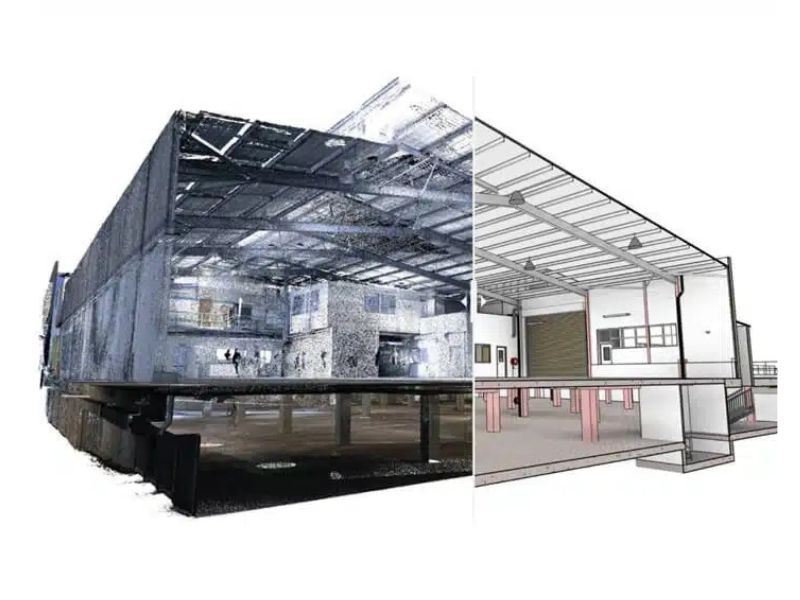
A laser scanning survey delivers rich, detailed spatial data. Below are examples of the types of outputs we produce — from raw point cloud files to extracted CAD drawings.
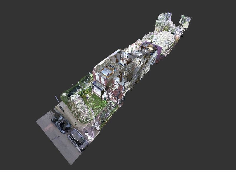
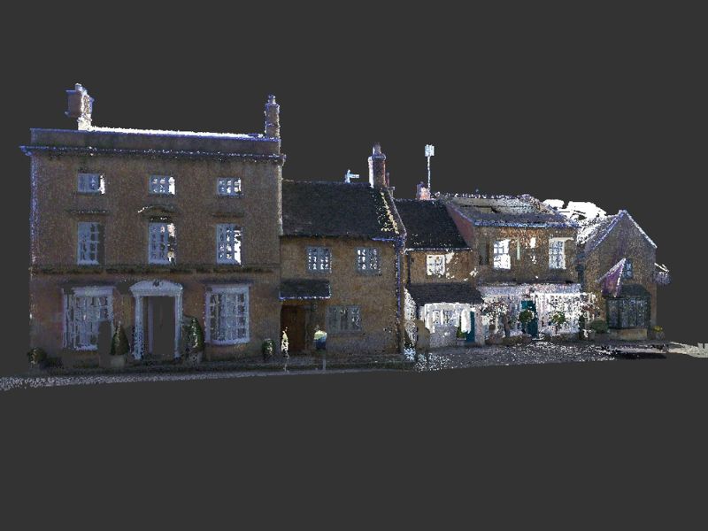
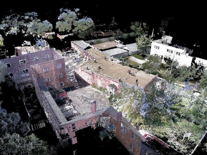
Colourised point cloud — full building interior captured in 3D
Point cloud section — precise slice through the building at any level
Floor plan extracted from point cloud data
Elevation extracted from point cloud data
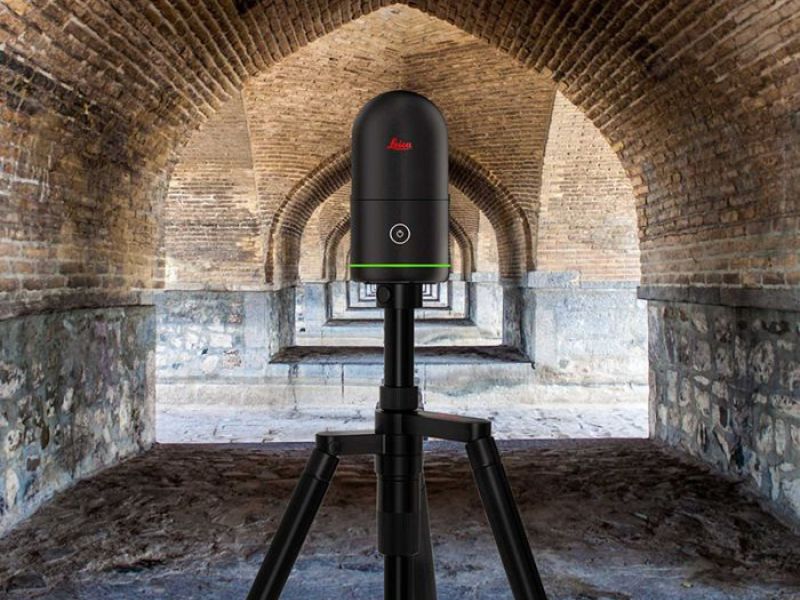
Leica BLK360 scanner in position on site
ReCap point cloud loaded in Autodesk software
Recent Projects
A selection of 3D laser scanning projects completed for architects, BIM coordinators and heritage consultants across the UK.

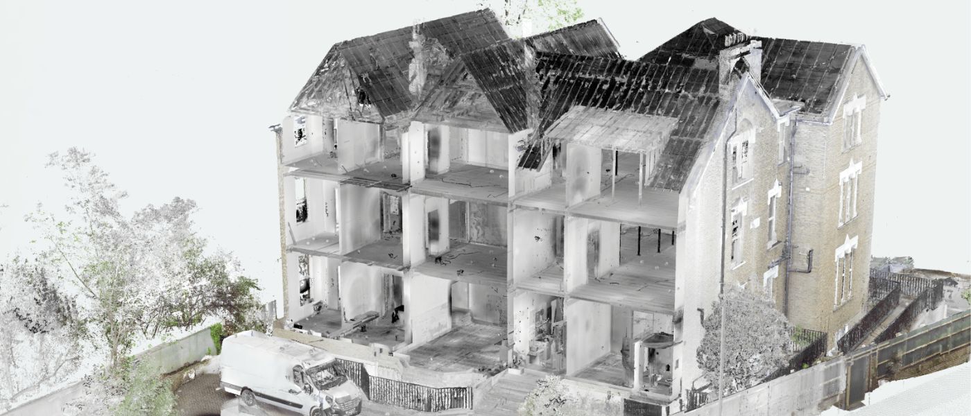
Luxury Period Residence — Hampstead, London
A comprehensive laser scanning survey of a large high-value period residence ahead of extensive structural alterations. Complex multi-level layout and ornate architectural detailing captured completely in a single site visit — full internal and external dataset delivered in 4 working days.
- No return site visits required
- Structural design progressed without delays
- Full internal and external dataset delivered