Measured Building
Surveys
Accurate floor plans, elevations, sections and roof plans for residential and commercial properties — delivered to a professional standard for design, planning and construction.
Add photo: mbs-hero.jpg
Recommended 1400 x 600pxWhat is a Measured Building Survey?
A measured building survey records the physical layout and geometry of an existing building. It captures accurate dimensions, structural features and key elements to create a reliable base for design, planning and construction work.
This information is typically used by architects, designers, engineers and contractors at early project stages to ensure any proposed works are based on verified, accurate existing conditions. Without an accurate measured survey, design decisions are made on assumptions — a measured building survey removes that risk entirely.
What We Can Provide
Our measured building surveys are tailored to suit the specific requirements of each project. Depending on your needs, we can provide:
- Existing floor plans showing room layouts, wall thicknesses and key features
- Elevations showing external building features, openings and heights
- Sections to illustrate internal layouts and level changes
- Roof plans where required for planning or design use
- Floor-to-ceiling heights and level information throughout
- Clearly identified doors, windows and openings with sizes
- Key structural elements captured as part of the survey
- Reflected ceiling plans where required
Deliverables are agreed at the outset to ensure survey information is appropriate for its intended use.
What We Survey
- Residential properties — houses, apartments and flats
- Commercial buildings — offices, retail, mixed-use
- Industrial units and warehouses
- Listed and historic buildings requiring careful survey methodology
- Refurbishment and retrofit projects
- Educational and institutional buildings
Our Surveying Process
Fast, Accurate Data Collection
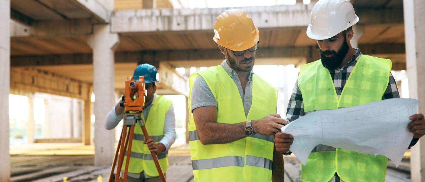
We carry out efficient on-site surveys using appropriate surveying methods and modern equipment to capture accurate measurements with minimal disruption. The survey approach — whether traditional measurement, digital tools or laser scanning — is selected to suit the building type, access and required level of detail.
Data Analysis & Quality Assurance
Survey data is carefully processed, checked and validated to ensure accuracy, consistency and completeness before any drawings are produced. Our quality control stage cross-checks measurements and identifies any discrepancies before they reach your drawings.
Fast, Reliable Delivery
Final CAD drawings are produced using professional workflows and issued in agreed formats within clear timescales. All drawings are clearly annotated, correctly scaled and structured for immediate use in design and planning software.
CAD & Drawing Standards
All drawings are produced to a professional standard and structured to integrate directly into your existing project files without the need for significant rework. Our standard CAD output includes:
- Clean, logical layer structure throughout
- Correct line weights for print and screen use
- Clear annotation with room names, dimensions and levels
- Scaled layouts suitable for planning and construction use
- Compatible with AutoCAD and BricsCAD workflows
Why Choose SurveyX
Accuracy-Led Approach
Accuracy is at the core of every survey we undertake. We use appropriate surveying methods and thorough quality checks to ensure the information provided is reliable and fit for purpose.
Industry-Standard Workflows
All drawings are produced using professional CAD systems fully compatible with AutoCAD and BricsCAD, ensuring seamless integration into established design workflows.
Clean, Usable Deliverables
We focus on producing well-structured drawings ready for immediate use — reducing the time your team spends cleaning or reworking files before design can begin.
Efficient Turnaround Times
Streamlined surveying and production processes allow us to deliver survey drawings promptly without compromising on quality or accuracy.
Experience Across Varied Projects
We have experience across a wide range of residential and commercial building types, adapting our approach to suit different access constraints, building ages and project requirements.
What is a Measured Building Survey?
A measured building survey records the physical layout and geometry of an existing building in precise detail. Using calibrated measuring equipment and professional surveying techniques, we capture accurate dimensions, structural features and all key building elements to create a verified, reliable base for any design, planning or construction project.
The survey produces a complete set of drawings representing the building as it exists — not as it was originally designed or built. Over time, buildings change: walls are moved, openings are altered, additions are made. A measured building survey captures the building as it actually stands today, giving your design team verified information to work from rather than guesswork.
This is the standard starting point for virtually any project involving an existing building — from a simple extension to a major refurbishment or change of use.
What You Receive
Each measured building survey is delivered as a complete set of professional CAD drawings. Below are examples of the types of outputs we produce. .
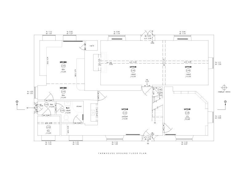
Existing floor plan — showing room layout, wall thicknesses and openings
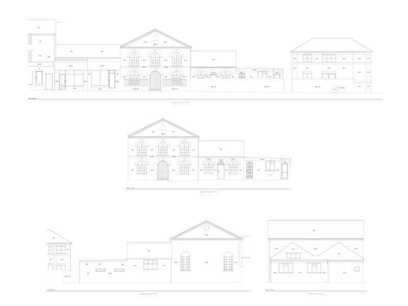
Elevation drawing — external face of building with heights and openings
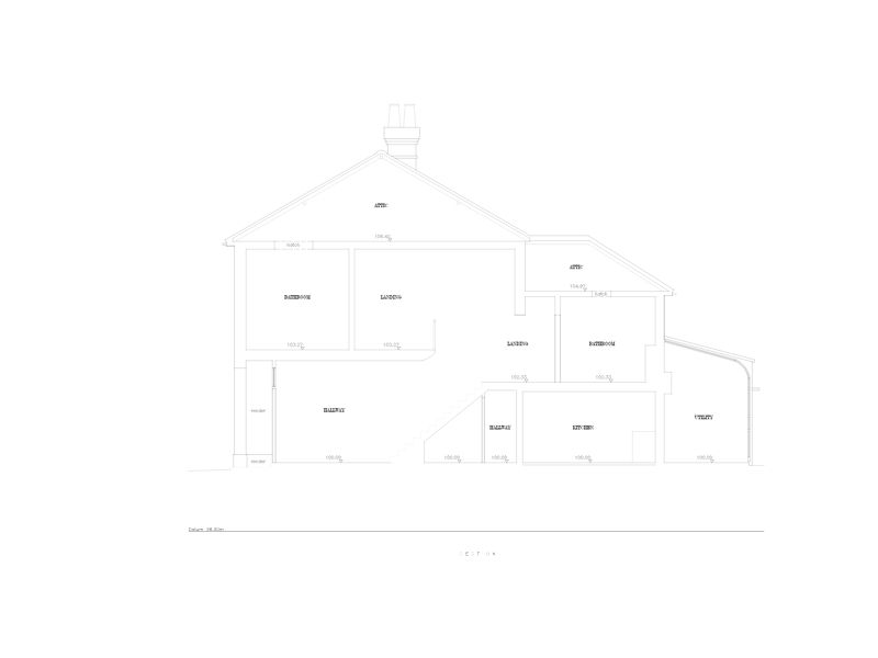
Cross section — illustrating internal levels and structural elements
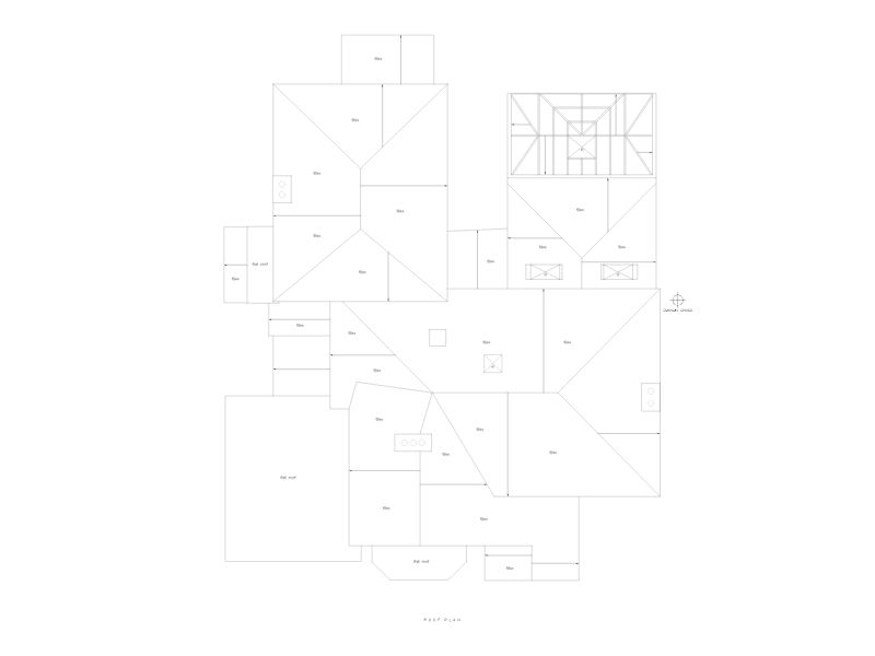
Roof plan — ridge lines, valleys, pitches and features
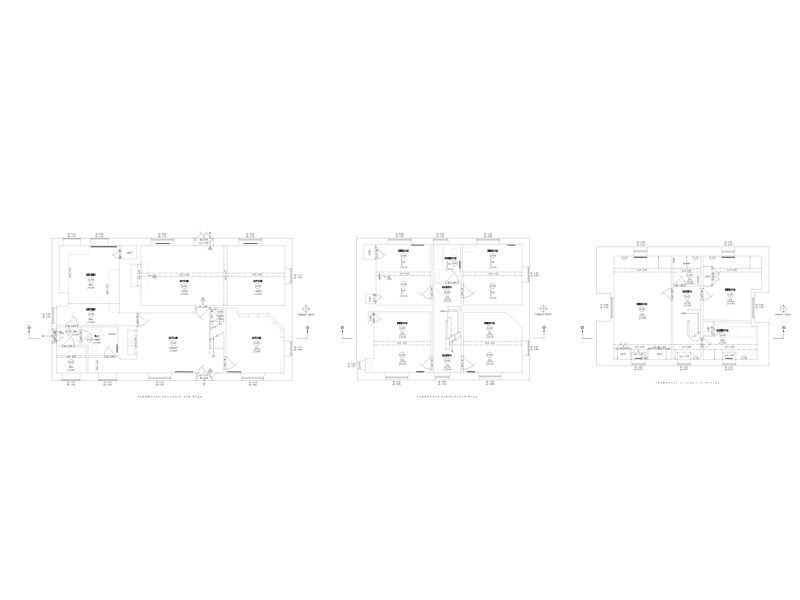
Multiple Floor Plans — Showing Building Levels
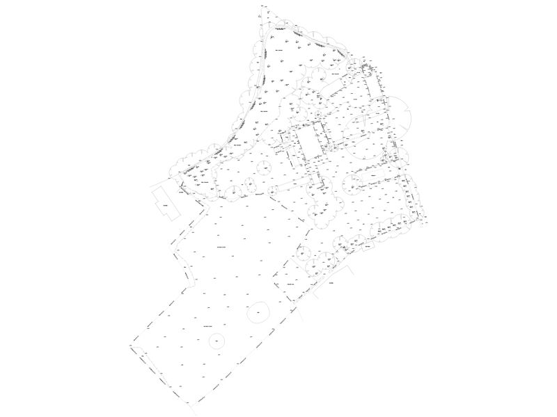
Site plan — building in context with boundaries and levels
Recent Projects
A selection of measured building survey projects completed for architects, developers and property professionals across the UK.
Extended Family Home Survey — Solihull
A full measured building survey of a large extended semi-detached in Solihull ahead of a rear and loft extension. Multiple alterations over time had created irregular wall alignments and complex roof geometry — all captured in a single site visit using the Leica BLK360.
- Full survey completed in a single visit
- Accurate CAD drawings in 3 working days
- Architect able to proceed immediately